WALT Maps & Media

Community-based design to create and use data and media advocating for housing justice.
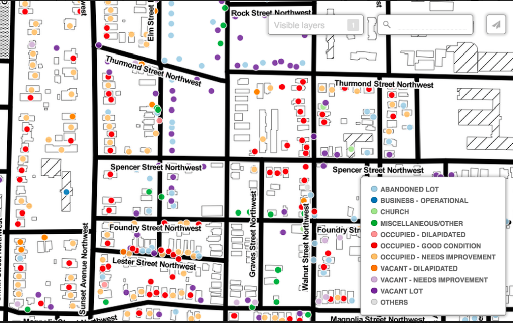
The Westside Atlanta Land Trust (WALT) is an organization for community empowerment centered around affordable housing in the English Avenue and Vine City neighborhoods of the westside of Atlanta. After finding county datasets on abandoned and vacant lots incomplete and inaccurate, WALT collected their dataset of the neighborhoods’ built environment using handheld devices enabled with ArcGIS software. They then combined their data with county back tax data and developed a strategy to acquire lots that could be zoned as a community land trust to control rising prices and taxes and thwart gentrification.
From 2014 - 2019 we collaborated with WALT to create and use data and digital media as advocacy tools toward their goals of housing justice. Working together, we produced custom datasets, maps, graphics, videos, and other informational media to help make a case for a community land trust in the English Avenue and Vine City neighborhoods. This work combined design and participatory action research, civic media, advocacy, and policy, in an ongoing effort to care with the communities and residents of these historic neighborhoods in Atlanta.
2015-2018
Concept and Research: Amanda Meng, Ellen Zegura, and Carl DiSalvo
Community Lead and Partner: Westside Atlanta Land Trust
Data Work and Maps: Amanda Meng
Related Publications:
Meng, Amanda, Carl DiSalvo, and Ellen Zegura. 2019. “Collaborative Data Work Towards a Caring Democracy.” In Proc. ACM Hum.-Comput. Interact. 3, CSCW, Article 42 (November 2019)
Meng, Amanda, and Carl DiSalvo. "Grassroots Resource Mobilization through Counter-Data Action." Big Data & Society 5, no. 2 (2018): 2053951718796862.
Zegura, Ellen, Carl DiSalvo, and Amanda Meng. 2018. “Care and the Practice of Data Science for Social Good.” In Proc of the 1st ACM SIGCAS Conference on Computing and Sustainable Societies (COMPASS '18). Association for Computing Machinery, New York, NY, USA, Article 34.